https://www.americancityandcounty.com/wp-content/themes/acc_child/assets/images/logo/footer-logo.png
  • Home
  • Co-op Solutions
  • Commentaries
  • News
  • In-Depth
  • Multimedia
    • Back
    • Podcast
  • Resources
    • Back
    • Resources
    • Webinars
    • White Papers
    • Events
    • How to Contribute
    • Municipal Cost Index – Archive
    • Equipment Watch Page
    • American City & County Awards
  • Magazine
    • Back
    • Digital Editions
    • Reprints & Reuse
    • Advertise
  • About Us
    • Back
    • About Us
    • Contact Us
    • Privacy Statement
    • Terms of Service
American City and County
  • NEWSLETTER
  • Home
  • Co-op Solutions
  • Commentaries
  • News
  • In-Depth
  • Multimedia
    • Back
    • Podcasts
  • Resources
    • Back
    • Webinars
    • White Papers
    • Events
    • How to Contribute
    • American City & County Awards
    • Municipal Cost Index
    • Equipment Watch Page
  • Magazine
    • Back
    • Digital Editions
    • Reprints & Reuse
    • Subscribe to GovPro
    • Manage GovPro Subscription
    • Advertise
  • About Us
    • Back
    • About Us
    • Contact Us
    • Cookie Policy
    • Privacy Stament
    • Terms of Service
  • newsletter
  • Administration
  • Economy & Finance
  • Procurement
  • Public Safety
  • Public Works & Utilities
  • Smart Cities & Technology
acc.com

Smart Cities & Technology


Article

Map platform puts open data to work in Los Angeles (with related video)

Map platform puts open data to work in Los Angeles (with related video)

Los Angeles’ new GeoHub makes more than 500 types of map data available to residents, city workers, and private industry.
  • Written by mikekeat
  • 5th February 2016

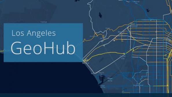
Los Angeles’ new GeoHub is up and running. It is a collection of urban map data. The system makes more than 500 types of map data available to residents, city workers, and private industry. The GeoHub helps Angelenos better understand their communities, and city departments better coordinate construction, road paving, and public safety efforts.

“On its own, data gives us important insights into how our city works, and now we are putting open data to work,” said Los Angeles Mayor Eric Garcetti at the system’s recent launch. “The GeoHub provides real-time access to all the data we need in one convenient place, allowing us to improve everything from pothole repair to 311 call times, make smarter urban planning decisions, and make it easier for emergency responders to get to their next location. This is back to basics at its best.”

GeoHub is one part of Mayor Garcetti’s broader strategy of using technology and data to delivery transparency, efficiency and community engagement.

The system was created in collaboration with Esri, a provider of geographic information systems (GIS) technology. GeoHub was built on Esri’s ArcGIS platform. The system pools map data layers from more than 20 different departments — allowing users to create living maps and build custom applications to solve pressing challenges and optimize city services.

By pooling key data sets, and mapping their locations, city departments are now equipped with tools to get their work done more quickly and efficiently. The setup provides a complete picture of what’s happening on the streets of Los Angeles — including real-time traffic data, road obstructions, the inspection status of nearby buildings, business activity, as well as the nearest fire hydrants. GeoHub can help firefighters, sanitation workers, utility workers and all city personnel better understand the neighborhoods they serve.

With the system, city staff will spend less time searching for and recreating existing data points and more time using location-based data and real-time mapping tools to increase operational efficiencies. The setup enables easier access to location-based data for citizens, academia, NGOs and businesses. In addition, city staffs, businesses, researchers, trade groups, students and others can easily create new apps from the hub application program interfaces (APIs).

To show the power and range of the hub, Los Angeles is developing three flagship applications: “Streetwize,” which shows all of the permitted activity on the city’s public right of ways; “The Road to 2400,” which tracks the Bureau of Street Services’ progress on paving at least 2,400 lane miles per year; and “Vision Zero High Injury Network,” which can help improve pedestrian safety by providing users with key information — including where schools and high speed streets intersect.

The LA system is about bringing information and people together, says Brian Cross, Director of Professional Services at Esri. “The GeoHub connects city departments and regional stakeholders using a location-as-a-service platform (LaaS) to plan and support city operations efficiently. Residents, businesses, and NGOs can also use the Esri enterprise location engine to make decisions at speed and scale to engender thriving, dynamic communities.”

Cross lists three main steps to the creation of the hub setup:
—    Orientation and planning: Engagement begins with understanding and getting agreement on city priorities and initiatives to be addressed.

—    Implementation of infrastructure: (1) assessing and inventorying available data, maps, apps and gaps, (2) implementing open web services, (3) configuration of key apps, and (4) creation of open data environment.

—    Education, training and outreach: including workforce education, community workshops, support for community “Hub Connect Days” and support for app challenges to start the community down the engagement path using their GIS Hub.

Cross says cities can undertake these steps themselves, or enlist Esri’s assistance. In addition to steps for “how” to create a Hub environment, Cross says there are some important characteristics to consider.

—    Executive sponsorship is critical.

—    You need a champion who can bridge the executive goals with the technical and departmental capabilities.  This is usually a Chief Data Officer, Chief Innovation Officers, or a similar role.

—    It’s best to have existing GIS/IT Technology in place.

Cross adds: “There needs to be a desire for cross-cutting organizational initiatives to support data sharing.”

In the video, Los Angeles Mayor Eric Garcetti and Esri President Jack Dangermond unveil L.A.’s GeoHub system.

_____________

To get connected and stay up-to-date with similar content from American City & County:
Like us on Facebook

Follow us on Twitter
Watch us on Youtube

Tags: Public Works & Utilities Smart Cities & Technology Article

Related


  • ASCE releases 2021 Report Card for America’s Infrastructure
    The American Society of Civil Engineers (ASCE) today released its 2021 Report Card for America’s Infrastructure, looking at the state of the country’s infrastructure across 17 categories. The Report Card is compiled every four years by America’s civil engineers to provide a comprehensive assessment of the nation’s major infrastructure categories, using a simple A to […]
  • Updating the assessor report: A new approach
    Ramsey County, Minn.'s new guiding practice is that any dataset available on its open data portal must include a data story
  • 2020 Crown Communities winner: Phases 2 and 3 of Minot, N.D.'s Mouse River Enhanced Flood Protection Plan
    Phases 2 and 3 of Minot, N.D.’s Mouse River Enhanced Flood Protection Plan involved numerous federal, state and local entities, several setbacks, years to complete and $40 million. But the result was a multi-faceted flooding defense that Minot was able to make its own. Historic flooding of the Mouse River in June 2011 created the […]
  • 2020 Crown Communities winner: Harris County, Texas, Precinct 2's ACCESS2HEALTH SmartPod
    Precinct 2 of Harris County, Texas, implemented a medical college’s innovative epidemiological technology to bring COVID-19 testing to its vulnerable residents. However, the precinct’s initiative and this technology could influence pandemic response across the country. Of all four precincts in Harris County, Texas, Precinct 2 has the lowest median life expectancy, the highest percentage of […]

Leave a comment Cancel reply

-or-

Log in with your American City and County account

Alternatively, post a comment by completing the form below:

Your email address will not be published. Required fields are marked *

Related Content

  • Six tips for making sure your dispatch is doing all the right moves
  • Artificial cities could pave the way to driverless adoption
  • Baltimore will distribute recycling carts to residents to encourage recycling
  • Buffalo, N.Y.'s 48 hours to navigate a mission-critical transition to remote work

White papers


Discover How Public Sector Officials are Monitoring and Managing Overtime in This New White Paper

22nd February 2021

How to Assemble a Successful Government Grant Proposal

5th February 2021

The Rise of Procurement’s Next Normal

5th February 2021
view all

Events


PODCAST


Young Leaders Episode 4 – Cyril Jefferson – City Councilman, High Point, North Carolina

13th October 2020

Young Leaders Episode 3 – Shannon Hardin – City Council President, Columbus, Ohio

27th July 2020

Young Leaders Episode 2 – Christian Williams – Development Services Planner, Goodyear, Ariz.

1st July 2020
view all

Twitter


AmerCityCounty

2020 Crown Communities winner: El Paso County, Texas’ pretrial justice modernization dlvr.it/Rv4GKL

6th March 2021
AmerCityCounty

A city’s innovative downtown master plan sees future in local, inclusive placemaking dlvr.it/Rv3SfM

5th March 2021
AmerCityCounty

2020 Crown Communities winner: Gainesville, Fla. closes Dignity Village and houses its homeless population dlvr.it/Rv1GS2

5th March 2021
AmerCityCounty

2020 Crown Communities Winner: South Bay Cities Council of Governments’ South Bay Fiber Network dlvr.it/Rv10b7

5th March 2021
AmerCityCounty

Senate American Rescue Plan includes more than $60 million in direct aid for counties dlvr.it/RtzvBK

4th March 2021
AmerCityCounty

ASCE releases 2021 Report Card for America’s Infrastructure dlvr.it/Rtvck5

3rd March 2021
AmerCityCounty

Updating the assessor report: A new approach dlvr.it/RttvDv

3rd March 2021
AmerCityCounty

2020 Crown Communities winner: Phases 2 and 3 of Minot, N.D.’s Mouse River Enhanced Flood Protection Plan dlvr.it/RtrWMC

3rd March 2021

Newsletters

Sign up for American City & County’s newsletters to receive regular news and information updates about local governments.

Resale Insights Dashboard

The Resale Insights Dashboard provides model-level data for the entire used equipment market to help you save time and money.

Municipal Cost Index

Updated monthly since 1978, our exclusive Municipal Cost Index shows the effects of inflation on the cost of providing municipal services

Media Kit and Advertising

Want to reach our digital audience? Learn more here.

DISCOVER MORE FROM INFORMA TECH

  • IWCE’s Urgent Communications
  • IWCE Expo

WORKING WITH US

  • About Us
  • Contact Us

FOLLOW American City and County ON SOCIAL

  • Privacy
  • CCPA: “Do Not Sell My Data”
  • Cookies Policy
  • Terms
Copyright © 2021 Informa PLC. Informa PLC is registered in England and Wales with company number 8860726 whose registered and Head office is 5 Howick Place, London, SW1P 1WG.
This website uses cookies, including third party ones, to allow for analysis of how people use our website in order to improve your experience and our services. By continuing to use our website, you agree to the use of such cookies. Click here for more information on our Cookie Policy and Privacy Policy.
X