https://www.americancityandcounty.com/wp-content/themes/acc_child/assets/images/logo/footer-logo.png
  • Home
  • Co-op Solutions
  • Hybrid Work
  • Commentaries
  • News
  • In-Depth
  • Multimedia
    • Back
    • Podcast
    • Latest videos
    • Product Guides
  • Resources & Events
    • Back
    • Resources
    • Webinars
    • White Papers
    • IWCE 2022
    • How to Contribute
    • Municipal Cost Index – Archive
    • Equipment Watch Page
    • American City & County Awards
  • About Us
    • Back
    • About Us
    • Contact Us
    • Advertise
    • Cookie Policy
    • Privacy Statement
    • Terms of Service
American City and County
  • NEWSLETTER
  • Home
  • Co-op Solutions
  • Hybrid Work
  • Commentaries
  • News
  • In-Depth
  • Multimedia
    • Back
    • Podcasts
    • Latest videos
    • Product Guides
  • Resources/Events
    • Back
    • Webinars
    • White Papers/eBooks
    • IWCE Expo
    • Calendar of Events
    • How to Contribute
    • American City & County Awards
    • Municipal Cost Index
    • Equipment Watch Page
  • About Us
    • Back
    • About Us
    • Contact Us
    • Advertise
    • Cookie Policy
    • Privacy Stament
    • Terms of Service
  • newsletter
  • Administration
  • Economy & Finance
  • Procurement
  • Public Safety
  • Public Works & Utilities
  • Smart Cities & Technology
  • Magazine
acc.com

Commentaries


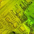
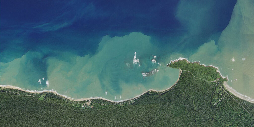
courtesy of Surdex Corp.

Commentary

Supporting hurricane response in Puerto Rico with aerial imagery

Supporting hurricane response in Puerto Rico with aerial imagery

  • Written by Tracy Ray
  • 29th June 2023

When Hurricane Fiona hit Puerto Rico in September of 2022, resultant flooding and landslides caused significant damage on the island. Local and federal government agencies and insurance companies needed to determine the location and extent of this damage in a timely manner for restoration and assessment. With such a large area of potential impact—Puerto Rico is about 3,500 square miles in area—evaluating the aftermath was no small feat.

The approach: Aerial imagery
One of the most efficient ways to assess damage across large expanses is to acquire aerial imagery from manned, fixed-wing aircraft. About a week and a half after Hurricane Fiona hit, the U.S. Department of Agriculture (USDA) sent a task order for imagery over the entire island to Missouri-based geospatial provider Surdex Corp., which proceeded to design and execute the imagery acquisition efforts.

Rapid delivery of aerial imagery for Fiona’s response efforts was ultimately made possible through a few key factors, supported by rapid communication:

  • An existing General Services Administration (GSA) contract that allowed a rapid contract response through the USDA PINE Ad Hoc and Disaster Support Programs
  • Conducting acquisition flights during all clear opportunities
  • Quick, minimal processing of imagery and upload to a web service

USDA PINE Ad Hoc and Disaster Support Programs
In 2022, the USDA established its five-year PINE Aerial Imagery Blanket Purchase Agreement (BPA) contract, selecting seven geospatial providers to facilitate the acquisition of aerial imagery through five different programs, each with unique purposes and specifications. Through the Ad Hoc and Disaster Support Programs, the USDA sent a task order to Surdex for 4-band (red, green, blue, near infrared) 30cm post-hurricane imagery over Puerto Rico with “relaxed” specifications. While most PINE programs require a minimum 30-degree sun angle and no cloud cover, this task order allowed a minimum 25-degree sun angle and up to 10 percent cloud cover to expedite acquisition.

Acquiring data on a perpetually cloudy island
Even with relaxed cloud cover specifications, it is very challenging to acquire imagery over Puerto Rico because as a Caribbean Island, it is prone to persistent clouds, especially in the higher elevations and rainforest areas of the island. The aerial imagery acquisition flights began mid-October 2022, and through taking advantage of every clear weather opportunity, acquisition was completed in January of 2023. To further facilitate rapid acquisition, in lieu of traditional ground survey methods, locational information for the image sensor was corrected using a base station, Continuously Operating Reference Stations (CORS) and existing survey points from a prior project.

hurricane

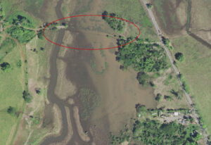
Road flooding in Puerto Rico

Quick upload
As the imagery was acquired, it was minimally processed and then posted to a web service within 10 days of each flight. To expedite delivery of the imagery, the initial processing did not include full rectification or color correction; those steps were completed later, after the entire project data set had been acquired. This preliminary imagery enabled government agencies such as the Federal Emergency Management Agency (FEMA) to begin using the imagery as quickly as possible for critical recovery efforts. FEMA uses imagery to perform pre- and post-disaster comparison to examine essential infrastructure features that might be damaged, such as power and water plants, bridges and roads.

Public/private collaboration
This project demonstrates how collaboration between private and public sectors results in efficient response to natural disasters. First, the government defines its objective and any specifications, then the private sector designs a solution that meets the government’s needs.

Through the PINE contract, the USDA and Surdex were able to work together and successfully and quickly provide the aerial imagery that federal agencies such as FEMA needed to respond to hurricane Fiona’s aftermath. The Ad Hoc and Disaster Support Programs have proven to be a valuable tool for supporting the people of the United States when natural disasters strike.

Tracy Ray, CMT-GIS, is the technical writer at Surdex Corporation. She started as an orthoimagery technician at Surdex before transitioning to her current role. She has a B.A. in Geography from the University of Nebraska–Lincoln and an M.A. in Geography from the University of Missouri–Columbia.

Tags: homepage-featured-2 homepage-featured-3 homepage-featured-4 Public Safety Smart Cities & Technology Commentaries Administration Commentaries Public Safety Smart Cities & Technology Commentary

Most Recent


  • artificial intelligence
    Artificial intelligence for cities and counties
    It appears that artificial intelligence (AI) is everything, everywhere and in every product the vendor community would have us buy. However, despite the hype, few dismiss it as just another high-tech fad. Indeed, some believe it is the third (or fourth) wave, depending on how one is counting in the ever-evolving digital age. As early […]
  • Report: Modern construction techniques, building codes protected structures that survived Lahaina fire
    More than a month after wildfire ripped through the historic community of Lahaina, Hawaii, emergency responders continue working to get a more comprehensive picture of what triggered the tragedy. The death toll remains at 115 people. A recent report from the Insurance Institute for Business and Home Safety’s research division unpacks why the fire was […]
  • dashboards
    Dashboards and software help simplify financial funding and reporting for cities and counties
    Governments are streamlining management of federal funds through technology, says Mike Bell, CEO of Envisio, which provides public dashboards, analytics and performance management software. About 150 local government, education and nonprofit organizations use his firm’s solutions to manage their strategic plans, improve performance and report on results. Envisio is helping local government agencies to satisfy […]
  • asthma
    The top 10 Asthma Capitals for 2023
    September is Asthma Peak Month thanks to ragweed pollen peaking, higher mold counts, the start of cold and flu season, and kids headed back to school. The Asthma and Allergy Foundation of America (AAFA) has released its 2023 Asthma Capitals report, which analyses data from the 100 most populated cities and reveals the most challenging […]

Leave a comment Cancel reply

-or-

Log in with your American City and County account

Alternatively, post a comment by completing the form below:

Your email address will not be published. Required fields are marked *

Related Content

  • Rapid delivery of mapping data is critical for natural disaster response

WHITE PAPERS


7 Resources to Level-up Your Federal Grants Administration and Compliance

5th September 2023

Elevator Phone Line Replacement Strategy | A Guide to Reliable, Code-Compliant Solutions

29th August 2023

2023 State of Public Sourcing Report: The Bright Future of Public Procurement

23rd August 2023
view all

Webinars


Grant Preparedness: Unlocking Funding Opportunities for Your Success

10th August 2023

2023 State of Public Sourcing: Taking Local Governments into a Bright Future

1st August 2023

Stop Playing with Fire: How to Manage Infrastructure Asset Risk So You Know You’re Covered

20th June 2023
view all

Podcast


Young Leaders Episode 4 – Cyril Jefferson – City Councilman, High Point, North Carolina

13th October 2020

Young Leaders Episode 3 – Shannon Hardin – City Council President, Columbus, Ohio

27th July 2020

Young Leaders Episode 2 – Christian Williams – Development Services Planner, Goodyear, Ariz.

1st July 2020
view all

GALLERIES


Gallery: Hottest temperatures recorded in American cities during July

12th September 2023

The top 10 Asthma Capitals for 2023

7th September 2023

U.S. cities with the cleanest air from latest “State of the Air” report

5th September 2023
view all

Twitter


Newsletters

Sign up for American City & County’s newsletters to receive regular news and information updates about local governments.

Resale Insights Dashboard

The Resale Insights Dashboard provides model-level data for the entire used equipment market to help you save time and money.

Municipal Cost Index

Updated monthly since 1978, our exclusive Municipal Cost Index shows the effects of inflation on the cost of providing municipal services

Media Kit and Advertising

Want to reach our digital audience? Learn more here.

DISCOVER MORE FROM INFORMA TECH

  • IWCE’s Urgent Communications
  • IWCE Expo

WORKING WITH US

  • About Us
  • Contact Us

FOLLOW American City and County ON SOCIAL

  • Privacy
  • CCPA: “Do Not Sell My Data”
  • Cookie Policy
  • Terms
Copyright © 2023 Informa PLC. Informa PLC is registered in England and Wales with company number 8860726 whose registered and Head office is 5 Howick Place, London, SW1P 1WG.