Bringing ITS to rural America
Intelligent Transportation Systems (ITS) technology has helped millions of urban motorists get where they are going quicker, safer and with little hassle. But rural drivers, those for whom congestion and rush hour are not concerns, have not always seen the benefits of ITS. However, ITS offers a variety of components — GPS, communications equipment and weather sensors, for instance — that can be assembled to meet the unique needs of any area, urban or rural.
Urban drivers may worry about streets that look like parking lots, traffic copters buzzing overhead and fist-shaking road rage, but rural residents are more concerned with icy bridges, blind curves and inefficient emergency response services. Indeed, it can be safely said that, for rural drivers, getting there in one piece is more important than getting there faster.
Data from the U.S. Department of Transportation (USDOT) explains their concerns about safety: 61 percent of all fatal accidents in the United States occur on rural roads. That is true despite the fact that rural roads account for about 40 percent of all vehicle miles traveled each year.
Partly to reduce the number of fatalities, in the mid-1990s, USDOT established the Advanced Rural Transportation Systems Strategic Plan to harness the information-sharing capabilities of ITS for the benefit of rural residents and motorists. Much of the funding will come from the recently enacted TEA21 federal transportation bill.
The strategic plan addresses such rural attributes as large variances in travel speeds; steep grades/blind corners; few passing lanes; few convenient detour options; infrequent maintenance on secondary roads; and a higher incidence of motor vehicle deaths. (The strategic plan’s multiple goals also include reducing travel time and cost; relieving congestion at national parks such as Yellowstone and Yosemite; improving the safety of hazardous transport; helping former welfare recipients get to work; ensuring that elderly Medicare patients get to the doctor; and offering greater convenience to travelers.) The plan seeks to employ ITS technology for the following applications.
* Emergency services. Reducing response time is a high priority. “I see that as probably the most important [ITS] issue in rural areas,” says Jill Hough, a transportation economist with North Dakota State University in Fargo.
One of the key solutions, she says, will be “Mayday” systems that can integrate common devices such as cell phones with GPS and be programmed to alert dispatchers to the location, nature and extent of a problem. Commercially available, in-vehicle Mayday equipment (which works anywhere there is cellular phone coverage) includes RESCU, from Ford; OnStar, from General Motors; and BART, developed by Sarasota, Fla.-based Bartizan American Communications and manufactured by Schaumburg, Ill.-based Motorola.
Such technology can eliminate a frequent dilemma for dispatchers: the sometimes tricky business of getting a frantic caller to promptly provide crucial specifics about an accident or emergency — information that, if inaccurate or incomplete, can hinder emergency response personnel.
However, local public safety answering points (PSAPs) are not yet able to receive Mayday messages, according to Doug Funke, a project manager with Washington, D.C.-based Veridian Corp., an aerospace and transportation research firm. Commercially available Mayday systems currently operate by sending voice messages to national message centers, which in turn contact local PSAPs.
In Minnesota, Mayday Plus is a public-private effort to integrate in-vehicle Mayday equipment with existing emergency response systems, says Ginny Crowson of the Minnesota Department of Transportation’s Office of Advanced Transportation Systems. The partnership will test the system in 11 counties this winter.
Emergency response time can be further reduced by equipping fire, police and ambulance vehicles with automatic vehicle locators (AVLs), computer-based vehicle tracking systems that use electronic tags and GPS. And on a larger scale, ITS enhances coordination and communication between agencies during disasters that necessitate a broad-based response.
* Traveler safety and security. Data from sources such as radar and weather sensors is transmitted to local cable television, radio, the Internet, and variable message signs to warn travelers of hazards such as fog, dust, rail crossings and work zones.
Safety surveillance and monitoring of transit vehicles, park-and-ride lots and rest areas also provide travelers and commuters peace of mind. Moreover, other technologies, such as collision-avoidance systems and in-vehicle monitoring systems, can help prevent accidents. For example, companies are developing advanced sensing systems that can assess a driver’s alertness level and sound an alarm if the driver dozes off, according to Hough.
* Infrastructure operations and maintenance. Automated management systems are being developed for bridges, pavement, work zones and roadside hardware. According to Kiowa (Okla.) County Commissioner Robert Boelte, the county uses a GPS receiver in conjunction with video equipment and a PC to record bridge inspections. The GPS input is incorporated into the camera’s video signal, ensuring that precise location coordinates are provided for areas in need of repair. The camera operator also can record verbal comments. “It provides more thorough documentation,” Boelte says.
The system is expected to save the county money on engineering inspections. Additionally, the county hopes to use GPS for road inspections, accident litigation, herbicide applications, bridge and road inventories, verification of sign placements and safety documentation.
* Fleet operations and maintenance. Numerous public transit agencies and counties are upgrading their dispatching and routing systems with technology such as GPS, routing software and AVLs. More efficient deployment of buses will be one benefit, making it easier for elderly patients to get to doctors’ offices or social service providers; and for former welfare recipients to reach workplaces, job training locations or childcare centers. Other fleet vehicles, such as garbage trucks and snow plows, also can be operated more efficiently with ITS technology. St. Paul, Minn.-based 3M, in conjunction with the Minnesota DOT, is experimenting with a magnetic tape that can be embedded into pavement both to provide guidance and warn drivers of snow plows that are straying off the road.
A vehicle-mounted sensor can detect the magnetic field of the tape and provide the driver with feedback indicating the vehicle’s position on the road. The guidance system allows plowing to continue when the road is buried under deep snow, lane delineation is indiscernible and visibility is poor because of blowing snow or darkness. In the past, such conditions have resulted in snow plows being driven off the road, damaging infrastructure such as fire hydrants and signs, or ending up in a ditch. “You’d be surprised how many people follow the snow plow right into the ditch,” says 3M spokeswoman Donna Fleming.
* Commercial vehicle operations. The same vehicle location technology, paging capabilities and on-the-road communication systems that enhance the operation of public transit buses and fleet vehicles also can be used to foster a prosperous rural economy. For example, the technology can assist farmers as they transport crops to market.
* Public traveler/public mobility services. Mobile data terminals, AVLs, GPS and “smart card” payment devices are among the transit equipment that improves efficiencies, conserves fuel, reduces pollution, and saves wear-and-tear on buses, according to William Wiggins, a transportation programs specialist with the Federal Transit Administration, Washington, D.C. Wiggins cites Sweetwater County, Wyo., as an example of how technology can improve public transit efficiency.
Sweetwater County Transit was formed about nine years ago with the merger of five transportation agencies representing two senior citizens centers and centers for mental health, child development and drug rehabilitation. The agencies pooled their money and buses to serve a county of 44,000 people that is larger in area than the entire state of Vermont.
Before the agency was created, the county was served by a patchwork of criss-crossing buses that often overlapped each other while transporting passengers to various destinations throughout the county. Today, the agency consists of a well-coordinated fleet of 15 paratransit buses orchestrated by a semi-automated dispatching system. Sweetwater County Transit operates on an annual budget of less than $500,000 and hosts between 70,000 and 80,000 riders per year. Its funding comes from the state and from the human service agencies with which it contracts.
By June, mobile data terminals and AVLs will be installed in the agency’s buses. The terminals reduce voice transmissions by providing data messages to drivers. Johnson says bus drivers sometimes misunderstand a dispatcher when voice commands are issued and subsequently drive out of their way, wasting time and fuel. For example, the driver might think the dispatcher said “Seventh Street” when she actually said “Eleventh Street.”
* Tourism and travel information services. In Cape Cod, Mass., nearly $1 million in federal grant money is being used to establish an Advanced Public Transportation System (APTS). The system will employ such components as GPS, AVLs, a GIS-based customer information system, electronic fare technology and mobile data terminals.
More efficient public transit, it is hoped, will spell relief for weary residents whose roads are choked with tourism-related traffic each summer. The area’s resident population triples to as high as 600,000 during the peak tourism season, says Larry Harman, APTS project manager.
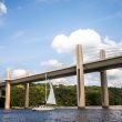
The popular tourist destination is within an eight-hour drive of 110 million people, and it shows. “The only way you can get on is with two bridges that were built in the 1930s,” Harman says. “It acts as a fairly dramatic chokepoint for people getting on and getting off.” In fact, on a typical Sunday afternoon during tourist season, as people try to leave the peninsula, the line of vehicles starting at the bridge stretches back across about half of the peninsula.
The Cape Cod Regional Transportation Authority and other planners have been working on the system for a year and hope to have it fully implemented in another year. So far, 20 AVL units are in place.
Of the authority’s 90 buses, 11 have fixed routes. More buses will be converted to fixed routes once the system’s new software can sort out ridership p atterns, Harman says. He adds that Cape Cod officials hope to encourage those with vacation homes to minimize the number of vehicles their family members bring to the peninsula. Improved public transit may help in that regard.
Cooperation essential As is often the case in major projects, whether they are oriented toward developing a municipal Intranet, building a high-tech wastewater plant or implementing technology to aid rural transportation, coordination among the involved parties is crucial to keeping things on track. “The issues aren’t really technical anymore; they’re institutional,” says Rob Puentes, senior ITS planner for Washington, D.C.-based ITS America.
He explains that interjurisdictional relationships must be nurtured, and cooperation between the public and private sectors encouraged. While the public sector is concerned first and foremost with improving highway conditions for rural residents and travelers, it need not worry about competitive pressures.
Conversely, the private sector has profits and competition to consider. Thus, it may not pursue certain opportunities that would not pay off on the bottom line — notwithstanding the immediate availability of the technology or benefits to the public. Establishment of a “national ITS architecture” (functions, physical subsystems such as the roadside or vehicles, and communications protocol) also is essential. “If everyone is using the same blueprint, (ITS implementation) is easier to achieve than if it is more of a piecemeal deployment,” Puentes says. To that end, federal legislation will require DOTs receiving ITS funds to comply with a national ITS architecture.
For more information on the Advanced Rural Transportation Systems Strategic Plan, access the ITS America web page, www.itsa.org. The Rural ITS Free Press web page (www. ruralits.org) also offers information, news and project descriptions.
The problem is real, and no one denies it: State and local treasuries do not have sufficient funds to repair, rehabilitate, replace or maintain the nation’s bridges. The solution, charging tolls on bridges, is basic, yet few are eager to implement it.
Charging a fee for services that traditionally cost nothing is never a popular option for government agencies. However, the alternatives are few, and the situation often is acute. Deteriorating or overloaded bridges need to be repaired or replaced.
The public’s reluctance to incur new charges can be eased somewhat if people understand why they are paying and believe they are getting something extra in return. A diligent and imaginative agency can address those matters by taking the following steps.
* Identify the problem’s significance. The first priority is to convince the public that a problem exists that is worth fixing. Transportation agencies understand the difference between a condition that only looks bad and one that is in dire need of remedy. Rather than describe a bridge as one that is nearing capacity, a traffic engineer should use a term — congestion — with which the public can easily relate. The long lines at rush hour will continue to grow, and the trip to and from work will take longer unless a bridge upgrade or replacement is made.
A caveat: Areas with large populations of senior citizens living on fixed incomes have a particularly difficult constituency — people who tend to be suspicious of any increase in expenses. Furthermore, the local media often inflames opposition to a new toll. However, if it projects the right message, a transportation agency usually can enlist the local media as an ally to educate the public about the unpleasant consequences of doing nothing to upgrade a bridge.
* Build it better. It is easier to place a toll on a bridge if people believe they will get something extra for their money. Increasing a bridge’s capacity by widening it and adding a lane in each direction, or improving access with upgrades to entrance and exit ramps can reassure them.
Concerns about toll collection slowing the flow of traffic can be addressed by using an electronic toll collection system or including a high-occupancy toll lane for vehicles with more than one person. If commuters are assured that a new toll bridge will save them time and make their trips less stressful, they are less likely to resist it.
* Define the facility’s role in the transportation system. Putting a toll on a bridge can create new problems in a community’s transportation system. If there are two equally accessible routes, only one of which is tolled, people are inclined to take the route that is free, creating an imbalance in traffic flow. The free route, as well as the local streets leading to it, will attract more vehicles and thus be more congested. Making the tolled facility easier to use is one way to restore some balance, but changes also must be made along the free route to keep the streets from getting clogged. Roadways might need to be widened, traffic lights synchronized or an entrance ramp configuration changed to make access easier.
* Develop a clear tolling policy. Since the aim of tolling is to generate revenue, setting the amount of the toll, along with possible discounts, is critical to the plan’s success. Reduced rates for regular users for off-peak travel are bound to win favor. Another strategy, offering user-group discounts, has become increasingly popular. For example, in New York City, Staten Island residents receive a discount on the Verrazano Narrows Bridge. In some instances, high-occupancy vehicle lanes might be given free passage to encourage car pooling.
* Look ahead. Whatever the plan, accurate estimates of various times and categories of travel are essential if revenues are to meet expectations. A realistic tolling structure at the outset is essential, because it is sometimes more difficult to raise a toll than to institute one, particularly if no new benefits are being offered. Ideally, the tolling policy should be drawn up carefully and announced early in order to win public support.
Despite the robust economy and many states’ healthy fiscal outlook, it is a given that many “free” bridges someday will have to exact tolls if they are to be properly rehabilitated or replaced. The public, never eager to pay new tolls or taxes, can nonetheless be enlisted as an ally if the case for tolls is made early and compellingly.
This article was written by Thomas Harknett, a senior associate for New York City-based Vollmer Associates.
Cities across the nation are re-evaluating their parking plans and adjusting them to better meet the needs of residents and commuters. Parking can have a far-reaching effect on everything from quality of life to economic growth, and it can serve as a moneymaker or a drain on resources, depending on how it is managed.
The good news for municipalities is that, in recent years, many new design techniques and technologies have emerged to make it easier for cities to meet their parking needs. The new tools include such innovations as “coinless” parking meters and “master” meters that serve multiple parking spaces, thereby eliminating the clutter of dozens of meters.
Following are descriptions of some emerging parking technologies and strategies: The coinless meter. Users can pay for parking with pre-paid debit cards or credit cards. Some meters even can recognize when a vehicle has left the space and reset themselves. That eliminates “free stays” in which vehicles can park in spaces that still have time on their meters, a practice that can cost municipalities thousands of dollars in lost revenues. Coinless meters also offer direct benefits to businesses, which can distribute debit cards to their customers as an incentive to shop in their stores.
The master meter. Also called the multi-spaced meter, the master meter is a single machine that can control parking revenues for an unlimited number of spaces. Parkers just note their space number and pay at the master meter using coins, dollar bills, or debit or credit cards. In addition to being less of an eyesore than the clutter of conventional meters, master meters simplify enforcement. Rather than read individual meters, officials can check the status of dozens of vehicles by looking at just one meter. While master meters are popular in Europe, American cities have been slow to adopt them, partly because of high installation costs.
The infrared meter. Using infrared technology, the meters reduce employee theft by tracking how many cars have used a space and how long each car was parked. Municipal parking administrators can now determine how much money should be in each meter and compare that figure to actual receipts. Additionally, planners get accurate information to assist them in determining how much to charge and how long parkers should be permitted to remain in a space.
Pay-on-foot. Upon leaving the parking area, drivers pay at a centrally located machine or cashier and receive a computer-generated card that is used to exit the building. A grace period (typically about 15 minutes) gives the driver time to get to his or her car and exit before incurring additional charges. Pay-on-foot reduces operating costs by eliminating the need for cashiers at the exit gates, and it eliminates the risk of employee theft or robbery. Because it requires fewer cashiers (or none at all), pay-on-foot can significantly cut labor costs and the expense of liability and workers’ compensation insurance premiums. Finally, unless there is only one exit lane, patrons do not have to sit in long lines when exiting a structure or large parking lot, which means greater convenience and a reduction in exhaust emissions. If a parking structure has only one exit lane, a cashier is necessary because some parkers may not have stopped at the pay-on-foot station before departing, or they may have exceeded the grace period while waiting in the exit line. In either case, they would need to pay as they exit.
Automatic vehicle recognition (AVR). With AVR (available only in pilot projects), the license plate and vehicle type is recorded by a camera and downloaded into a computer file when the vehicle arrives and leaves. The driver’s account is debited for the parking charge, or the driver pays a cashier.
In addition to serving as revenue sources, parking structures, when developed as intermodal facilities, also can serve as urban transportation centers. Intermodal structures can feature bus and rail terminals; park-and-ride connectors; and bike racks and lockers. As the hub of a city-wide parking program, they can play an important role in a city’s effort to reduce traffic congestion and support centers of commerce.
Those cities that respond to the challenges of congested streets, revenue shortfalls and demands for adequate parking by residents and employers will be better positioned to assure that parking will be an asset, both financially and in terms of quality of life, well into the future. Cities that fail to respond will be faced with a costly game of catch-up. This article was written by Richard Rich, executive director of parking planning for Rich and Associates, Southfield, Mich.
Officials from the Georgia Department of Transportation (GDOT) are trying out high-performance, carbon fiber-reinforced polymeric (FRP) material in several bridge maintenance and rehabilitation projects. Conducted in conjunction with the Georgia Institute of Technology, Atlanta, and the Federal Highway Administration, the research makes GDOT one of the first transportation departments in the U.S. to use the material on bridges.
The Lee Road Bridge over Interstate 20 in Douglas County, a bridge in Murray County, and one near St. Simons Island are being analyzed for results. The Lee Road Bridge suffers from cracks in its concrete deck, and researchers hope the FRP material will extend the bridge’s life at least five to 10 years.
On the Murray County bridge, GDOT contractors used sheets of carbon FRP material to repair pile caps during the spring of 1997, and now they are monitoring the material’s performance. “We are taking an integrated field/laboratory approach,” says lead researcher Abdul-Hamid Zureick, a professor at Georgia Tech’s School of Civil and Environmental Engineering. “We lack sufficient guidelines for engineers, contractors and departments of transportation regarding the use of these new materials.”
Generating national guidelines for FRP structure repair projects is a future goal of Zureick’s research, he says, adding that such guidelines could be formulated within three years. The need for repair guidelines stems from the widespread problem of the estimated 31 percent of bridges that are considered substandard. About half the bridges were built before 1940, and many have shorter durability because of carbonation caused by airborne pollutants and corrosion from de-icing salts. Increased daily traffic, heavier truck weights, more frequent vehicle overloads and insufficient repair funds also contribute to the problem.
“Traditional repair and replacement of bridge components, including bridge decks, pile caps and pre-stressed concrete beams, is very expensive,” Zureick says. “But with high-performance FRP composites technology, repairs can be made very fast, and that cuts costs in the long term.” In fact, the Lee Road bridge repair took less than a day; traditional repair methods could have taken several weeks.
Zureick’s team has worked intensely for three years, building on previous research that examined FRP use for construction projects and structure rehabilitation. So far, laboratory tests have determined that FRP materials can make bridges 30 to 40 percent stronger than the original design. Additional FRP material laboratory tests conducted in an environmental chamber are addressing every potential aspect of bridge component behavior during the structure’s lifespan, expected to be 75 years under current design criteria. Researchers are exposing components to extreme conditions, including humidity, temperature, salt and ultraviolet light. They will incorporate the durability data they collect into predictive models that will estimate FRP bridge component life-span, according to Zureick.
Workers use any of several available adhesives to apply readily available, but initially expensive FRP materials to bridge components. “It’s kind of like pasting on wallpaper,” Zureick says. “In fact, it is about as lightweight as wallpaper.” Two different types of FRP materials used on the Murray County bridge weigh 2 and 5 ounces per square foot — a fraction of the weight of traditional steel plates used for bridge repair.
San Gabriel, Calif., has found an affordable and fast alternative to replacing old asphalt streets with new ones in heavy traffic areas. The method involves the use of a flexible polymer cement combined with aggregates and sand to patch cracks and small potholes. Following application of the polymer mixture, an entire street can be resurfaced with a 3/8-inch slurry consisting of gravel, sand and a water/tar emulsion. The slurry restores some structure to the street; seals the pavement; and extends its life.
The end result, says Douglas Benash, a civil engineer for the city, is asphalt with a like-new appearance. On the basis of his experience over the past three years, Benash believes the combination of polymer repairs and slurry will delay by several years the need for reconstruction.
San Gabriel’s Community Development Department, which includes the public works and engineering departments, gets a $350,000 annual allotment to maintain 72 miles of streets, sidewalks, street lights and traffic signals. City workers generally provide temporary skin patches and pothole repairs mainly for residential streets, while independent contractors handle the major street restoration jobs.
Replacing old asphalt streets with new ones is only an option when outside funding sources are available, because the cost exceeds $250,000 per lane mile. For a six-lane street with two lanes of parking and a center median, the reconstruction cost exceeds $2 million per mile. In addition to being expensive, reconstruction creates big problems for business owners, their customers and motorists.
Access to business and shopping areas can be blocked for days, precipitating complaints from merchants and motorists. “I first tried rubberized crack sealing with a slurry overlay, but in less than a year the slurry wore off over the sealed cracks,” Benash says. Moreover, the substance proved tacky and slow to harden, causing pedestrians to inadvertently pick it up on their shoes and track it into buildings or houses.
The polymer cement, made by Percol Polymerics, Fountain Valley, Calif., originally was developed in the early 1980s to repair air force runways. Its use enables the city to close only a small portion of a single lane at any time, Benash says. “If I start after 9 a.m., after the morning rush hour, there is no traffic backup,” he says. “Repairs are ready for traffic just 10 minutes after they are completed, meaning that a given work area usually can be reopened less than an hour after it was closed off.”
The city’s first major use of the material came in 1997 during a restoration of a 1-mile section of Las Tunas Drive, the city’s largest and busiest street. The rehab, which began in August 1997 and was completed a month later, is holding up well more than a year later. Since then, the city has used the same technique to restore two more miles of the street. Additional projects using polymer cement are planned for this spring.
Benash acknowledges that polymer repair does have its limits. Potholes take a large volume of material, which drives costs up. And severely cracked areas with a deteriorated base should be removed and replaced with hot mix asphalt. Moreover, polymer repairs do not perform well unless the pavement is properly supported with a sound base. Although it is difficult to ascertain exact cost savings, Benash says that, because the polymer enables major repair projects to be deferred for several years, the savings will be significant in the long run.